Having good travel insurance when you attend one of our trips is a must. This can cover you for a range of things – which you can choose – and it is worth the investment for your peace of mind.
Benioff Zones – earthquake evidence for subduction

When we look at the earthquake evidence for Plate Tectonics, one amazing feature is the Benioff Zoned earthquakes that show the dipping of one plate under another and then into the mantle. When an earthquake occurs it is measured by
Galapagos Islands and Ecuador Andes Mountains, July 2022 (TRIP FULL)

Dr. Dan Kelley, geologist, and educator leads… Galapagos Islands and Ecuador Andes Mountains Students, Recent Graduates, Educators, and others 9-17 July, 2022 TRIP IS FULL! This nine-day (8 night) field trip to Ecuador and the Galapagos Islands will expand your knowledge
Are our school students really scientists?

I think it is wonderful that we are having students ask meaningful questions and undertaking studies to try and answer those questions. They are acting in part like scientists. But are our school students really scientists? What we are trying
Iceland 2021 Photos

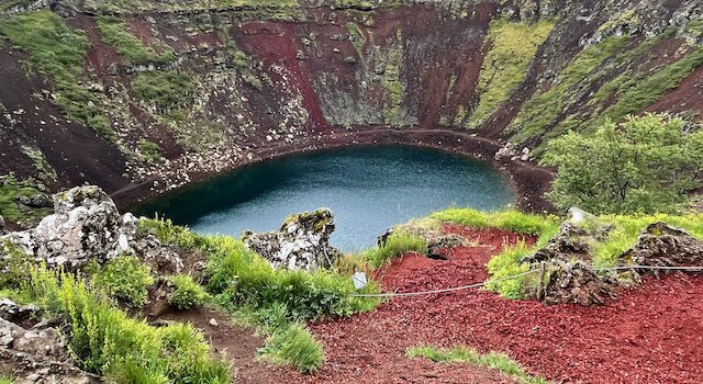
Just some of the photos from our 2021 Iceland trip.
TESTeacher Earthquakes – Free version

Welcome to The Earth Science Teacher. This is the quarterly member’s journal of GEOetc.com. Each quarter a new topic is covered that is relevant to the teaching of Earth Science. It is not full of ‘research papers’ – it is
The Volcanoes of Italy – July 2023 (TRIP FULL)

Gary Lewis, GEOetc and Chris Spencer, TravelingGeologist, lead… The Volcanoes of Italy A trip for Earth Science & Geography Teachers from around the world Teachers, Pre-service teachers, College Students, and their friends are welcome on this trip. 28 June – 7
Discover Iceland – Fire and Ice on a Mid-Ocean Ridge 2022 (TRIP FULL)

Discover Iceland – Fire and Ice on a Mid-Ocean Ridge 7-13 August 2022 TRIP ANNOUNCEMENT – Join our email list for more information. This 7-day (6 night) field trip to Iceland highlights the amazing geology of this Mid-Ocean Ridge country. We
Lava Risk – map interpretation

Have your students read data from a USGS lava risk map and interpret the most dangerous locations and where they would want to locate. This activity would take students 15-20 mins to complete. This is a great activity for
Thunder Island – podcast and then volcano eruption simulation activity

An in-class simulation where students play the role of scientists providing information about the possible eruption of volcanoes on an island. Have your students list to this 9-minute podcast on how volcanoes are monitored (this is optional) You split your