
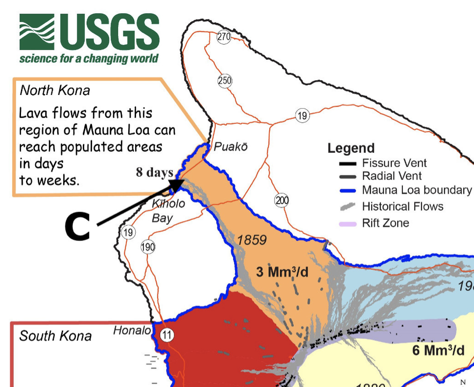
 Have your students read data from a USGS lava risk map and interpret the most dangerous locations and where they would want to locate.
This activity would take students 15-20 mins to complete.
This is a great activity for Natural Hazards and allows students to use a REAL USGS map for the Big Island of Hawaii.
Suggested answers and a downloadable full-size map image are provided for members here.
GEOetc has a Members Resources section that for a small cost gives you access to all the resources for FREE. New resources are added every month. Becoming a member costs you less than one coffee/water/tea a month – and supports us to continue developing resources to help you teach Earth science.
BECOME A MEMBER TODAY
Downloadable activity (Download)
Lava Risk – map interpretation